Category: News & Updates

  • A Nationally Significant Oasis Inspires a New Conservation Effort

    A Nationally Significant Oasis Inspires a New Conservation Effort

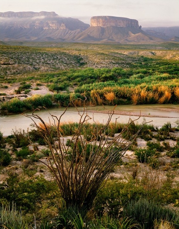
    In the heart of the Chihuahuan Desert, a network of springs has sustained life for thousands of years. 

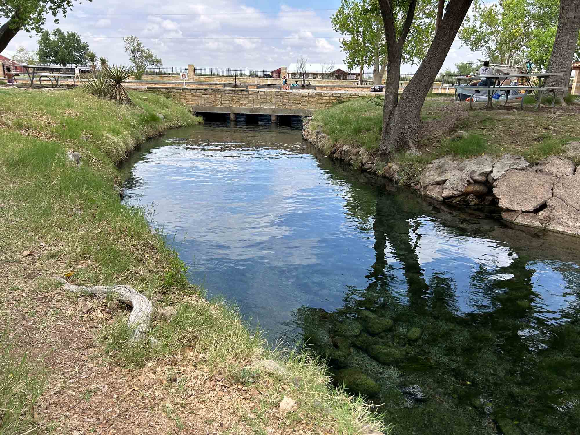
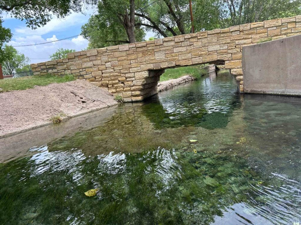
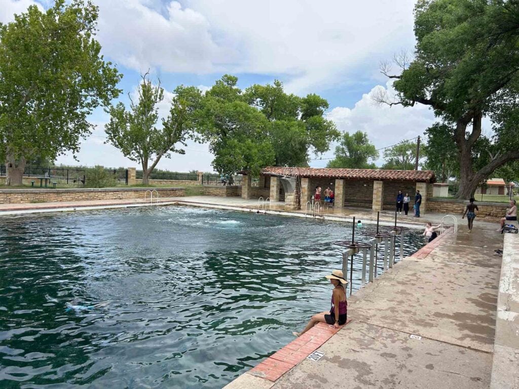
    San Solomon Springs, the largest of six artesian springs near Balmorhea, feeds the world-famous pool at Balmorhea State Park, supports rare desert wildlife and serves as a vital source of water in one of the driest regions of Texas. Millions of gallons of water flow through the springs each day, creating an oasis that has shaped the region’s ecology, economy and culture for generations. 

    Now, a growing coalition of researchers, landowners, community leaders and conservation partners is working to ensure those springs continue flowing well into the future. 

    The San Solomon Springs Collaborative, housed at the Meadows Research Institute for West Texas Water at Sul Ross State University, was created to advance research, strengthen community engagement and build a shared understanding of the groundwater systems that sustain the springs. 

    The effort comes at a pivotal moment. 

    Across Texas, roughly 30 percent of springs have disappeared completely and the rate of springs that are going dry has increased in recent decades.  Among those that remain, San Solomon Springs is considered one of the most significant desert spring systems in the state. Yet scientists have documented a long-term decline in spring flows. Phantom Spring, located at a higher elevation within the same regional system, has already stopped flowing entirely. 

    Researchers know that water reaching Balmorhea originates from precipitation falling in the Apache and Davis mountains and moves through complex underground pathways before emerging at the springs. But many questions remain unanswered.

    Water of San Solomon springs with retaining wall and bridge over the water.
    San Solomon Springs, the largest of six artesian springs near Balmorhea

    Where does the water recharge? How long does it remain underground? What pathways does it follow before reaching the springs? And what can be done to ensure the system remains healthy for future generations? 

    Those are the questions driving the collaborative. 

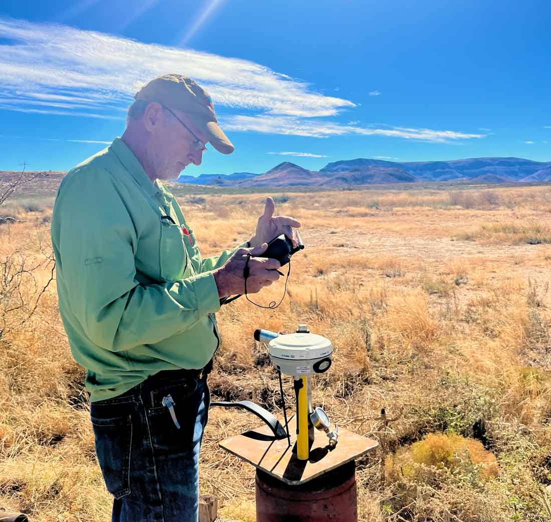
    “We don’t know the big picture yet, which has been the biggest unanswered thing,” said Dr. Kelbi Delaune, assistant professor of natural sciences and research scientist with the Meadows Research Institute. “What we’re trying to do is establish not only a groundwater monitoring network, but a landowner and stakeholder collaborative focused on protecting spring flow.” 

    The initiative brings together a diverse group of partners, including local groundwater conservation districts, farmers, ranchers, community members and conservation organizations. The collaborative seeks to advance science while building trust among those who live and work in the region. 

    That relationship-building component is every bit as important as the research itself. 

    “Everybody wants to see those springs flowing,” Delaune said. “It’s a nonpartisan issue.” 

    The collaborative is exploring ways to expand groundwater monitoring throughout the springshed while respecting landowner privacy and ensuring data is used responsibly. By improving understanding of groundwater movement and aquifer conditions, researchers hope to provide information that can help guide future stewardship efforts. 

    The work aligns closely with the mission of the Meadows Research Institute for West Texas Water, which was established to advance applied research, education and technical assistance related to water resources across the Trans-Pecos. 

    The San Solomon Springs system is also receiving increased national recognition. 

    Earlier this year, the site was designated a National Geoheritage Area, recognizing its exceptional geological, ecological and cultural significance. The designation highlights the springs as one of the nation’s important natural landscapes and underscores the value of protecting the resources that sustain them. 

    Long before she became a scientist, she first visited the region as a college student participating in field research. Nearly two decades later, she still returns to the same waters that inspired her career. 

    “These springs really were everything about my science identity and what it means to love nature and understand the culture and the people that use these resources,” she said. 

    Over the years, she has witnessed firsthand how closely connected the community is to the springs. When water levels decline or facilities close temporarily, the impacts ripple throughout the region. 

    Spring fed pool water with covered patio and people in and around the pool.
    San Solomon Springs feeds the world-famous pool at Balmorhea State Park.

    “When the pool closed for repairs for almost two years in 2019, the economy here sank, the overall community morale changed,” Delaune said. “It has closed off and on for various reasons since then, and it impacts the community every time. These springs are deeply ingrained in us.” 

    That connection gives her hope. 

    She points to growing public interest in water issues, stronger partnerships among stakeholders and the conversations sparked by events such as the recent Water in the Desert conference as evidence that attitudes are changing. 

    “People are talking about water differently than they used to,” she said. “We’re talking about it from economics, from culture, from future generations and from being good stewards of the land.” 

    Ultimately, she believes the springs serve as a reminder of just how connected West Texans are to the resource that sustains them. 

    “These springs and these systems are really what allow us to exist,” Delaune said. “If they don’t exist, we can’t exist.” 

    As the San Solomon Springs Collaborative continues to grow, organizers hope the effort will deepen scientific understanding, strengthen community partnerships and build lasting support for one of Texas’ most remarkable desert landscapes. 

    After all, protecting the future of San Solomon Springs means protecting the future of the communities, wildlife and landscapes that depend on them. 

  • Groundwater Monitoring Follows the Water Underground

    Groundwater Monitoring Follows the Water Underground

    Dr. Kevin Urbanczyk conducts groundwater monitoring field work.

    Water may be the most important resource in West Texas, but much of it remains hidden from view.

    Beneath the ranchlands, mountains and desert valleys of the Trans-Pecos, groundwater moves through a complex network of aquifers, fractures and underground pathways. Understanding where that water comes from, how it moves and how it changes over time is essential to protecting springs, sustaining communities and informing future water management decisions.

    That’s why the Meadows Research Institute for West Texas Water is working to expand a regional groundwater monitoring network across Far West Texas.

    The effort builds on decades of groundwater research led by Sul Ross State University scientists and includes monitoring wells in Brewster and Presidio counties, as well as new monitoring efforts associated with the San Solomon Springs Collaborative near Balmorhea. The goal is straightforward: collect long-term groundwater data that can help answer some of the region’s most important water questions.

    “Much of what we’re trying to do is simply understand the system better,” said Dr. Kevin Urbanczyk, senior research scientist at the Meadows Research Institute and professor of geology at Sul Ross State University.

    One of the institute’s highest priorities is understanding the groundwater system that feeds San Solomon Springs. Scientists know that much of the water originates west of Balmorhea, likely in the vicinity of Van Horn and the Apache Mountains, but important questions remain about the specific pathways the water follows underground before emerging at the springs.

    “We have a very clear idea that much of it is coming from the west,” Urbanczyk said. “But specifically, the path isn’t exactly clear. That’s what we’re looking for.”

    To help answer those questions, researchers are working with landowners to identify strategically located wells where groundwater levels can be monitored over time. Participation is voluntary, and landowners receive information about groundwater conditions on their property as well as regional groundwater trends.

     The monitoring effort may also include real-time telemetry systems that allow water levels to be tracked continuously.

    The monitoring network is about more than San Solomon Springs. Over the past several years, Urbanczyk and his collaborators have expanded monitoring efforts across Presidio County, building a network of more than 20 monitored wells that provide valuable information about long-term groundwater trends. That information has already helped groundwater conservation districts make more informed decisions about future water management.

    The work also supports one of the key priorities identified in the Meadows Research Institute’s strategic plan: expanding groundwater monitoring to improve understanding of aquifer conditions, groundwater flow paths and regional water availability. The institute envisions monitoring data playing an important role in future research, educational programs and technical assistance efforts throughout the region.

    The goal, Urbanczyk said, is to build a clearer picture of how groundwater moves across the region.

    “We want to understand the system,” he said. “The more information we have, the better equipped we’ll be to answer important questions about West Texas water.”

    That understanding could help answer longstanding questions about groundwater movement, identify recharge areas, improve water planning efforts and provide landowners and communities with better tools for stewardship.

    As the network expands, the institute is seeking opportunities to work with landowners in strategic locations throughout the region. Participation is voluntary, and landowners receive information about groundwater conditions on their property as well as regional groundwater trends.

    The institute continues to identify strategically located wells that can help fill critical gaps in researchers’ understanding of West Texas groundwater systems. Landowners interested in learning more about the groundwater monitoring network are encouraged to contact Urbanczyk at kevinu@sulross.edu.

    As the monitoring network grows, so too will the region’s ability to understand one of its most valuable and least visible natural resources.

    The water may be underground, but its future affects everyone who calls West Texas home.

  • Help Shape the Future of Water in West Texas

    Help Shape the Future of Water in West Texas

    Photo © Jim Bones

    The Meadows Research Institute for West Texas Water is building something big, and we’re growing the team to match.

    Following a landmark launch supported by a $2.75 million commitment from The Meadows Foundation, the institute is expanding its capacity to advance real-world water solutions across Far West Texas. 

    Now, we’re inviting bold, collaborative leaders to help take the next step.

    Two New Positions Now Open

    We are currently hiring for two key roles that will help shape our trajectory from the ground up:

    Director, Meadows Research Institute for West Texas Water
    This is a rare opportunity to lead a new, mission-driven institute focused on one of the most pressing challenges of our time. The Director will serve as the Institute’s primary ambassador, guiding strategy, building partnerships, advancing research and securing the resources needed to grow a world-class program rooted in the Trans-Pecos. 

    This role calls for a seasoned leader with deep experience in water or natural resources, and a vision for connecting science, education and community impact.

    Administrative Coordinator
    Behind every successful initiative is a strong operational backbone. This position will support day-to-day functions, coordinate communications and logistics, and help ensure the Institute’s work runs smoothly as it scales.

    Together, these roles will help build the foundation for a high-impact organization designed to serve communities, landowners, and water managers across the region.

    Why This Work Matters

    Water in Far West Texas is scarce, complex, and essential. From groundwater-dependent communities to iconic desert springs, the challenges are real and growing.

    The Meadows Research Institute for West Texas Water was created to meet this moment by advancing applied research, developing the next generation of water professionals, and delivering technical support where it’s needed most. 

    But just as important as the work itself is how it gets done. Collaboration, partnership, and a deep connection to place are at the core of the Meadows Research Institute’s approach.

    “The Meadows Research Institute was created for the region and with the region,” said Billy Tarrant, who is serving as interim director. “As we build this team, we’re looking for people who want to roll up their sleeves, work alongside communities, and help deliver real-world solutions that matter for West Texas.”

    Be Part of What Comes Next

    The momentum is building, from the success of the recent Water in the Desert conference to the development of new programs, partnerships and research initiatives.

    Now is the moment to get involved.

    If you’re ready to help shape the future of water in one of the most dynamic and challenging landscapes in Texas, we encourage you to explore these opportunities and apply.

    View open positions and apply: